Back to Outdoors
expert1.5 hours north to Lone Pine, then 30 min to Whitney Portal
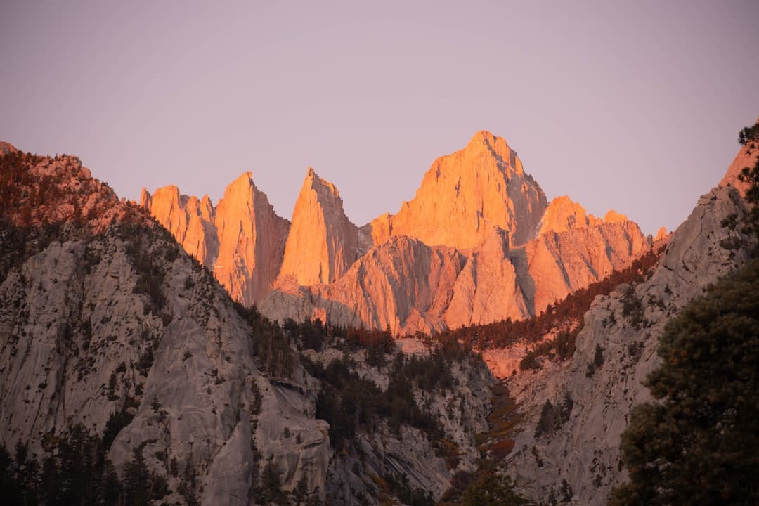
Highest Peak in the Contiguous US
Mount Whitney
HikingCampingPhotographyClimbing
Summit Elevation14,505 ft
Trail Distance22 miles round trip
Elevation Gain6,100+ ft
Trailhead (Portal)8,360 ft
PermitRequired (lottery)
Overview
At 14,505 feet, Mount Whitney is the highest peak in the contiguous United States and one of the most sought-after summit hikes in America. Rising dramatically from the Owens Valley floor near Lone Pine — just 1.5 hours north of Ridgecrest — Whitney's summit offers a 360-degree panorama that stretches from the Great Basin to the Sierra crest, encompassing a landscape so vast and wild that it defies comprehension.
The most popular route to the summit is the Mount Whitney Trail, an approximately 22-mile round trip starting from Whitney Portal at 8,360 feet. The trail gains over 6,100 feet of elevation as it switchbacks through alpine forests, crosses granite basins dotted with mountain lakes, traverses the famous 97 switchbacks, and follows an exposed ridge to the stone summit shelter built by the Smithsonian Institution in 1909. Most hikers attempt the summit as a very long day hike (14-18 hours) or as an overnight backpacking trip with a camp at one of the alpine lakes along the route.
Due to its immense popularity, overnight permits for the Whitney Trail are distributed through a lottery system that opens each February for the following summer season. Day-use permits are also required and available through a separate lottery. The hiking season typically runs from mid-July through mid-October, when the trail is mostly snow-free. The summit hike is physically demanding and should not be underestimated — altitude sickness is common above 12,000 feet, and weather can change rapidly with thunderstorms developing on summer afternoons.
Things to Do
Summit Day Hike
The classic Mount Whitney Trail is 22 miles round trip with 6,100 ft of gain. Most attempt it as a long day hike (14-18 hours), starting well before dawn. Requires day-use permit.
Overnight Backpacking Trip
Camp at Trail Camp (12,000 ft) or one of the alpine lakes, then summit the next morning. Requires overnight permit through the lottery system.
Whitney Portal Day Trip
Even without summiting, the drive to Whitney Portal and short hikes from the trailhead offer spectacular Sierra scenery and access to alpine forest and streams.
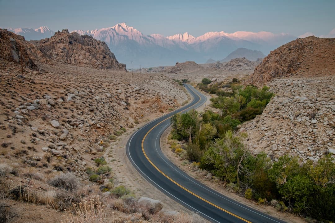
Photography from Lone Pine
Mount Whitney and the Whitney massif are stunning when viewed from the Alabama Hills near Lone Pine, especially at sunrise when alpenglow paints the peaks.
Highlights
14,505 ft — highest peak in the contiguous United States22-mile round trip summit trail with 6,100 ft elevation gain360-degree panoramic views from the summitHistoric Smithsonian stone shelter at the summit (built 1909)Permit required — lottery system for one of America's most popular hikesTrail Camp and Consultation Lake for overnight campingWhitney Portal at 8,360 ft — trailhead with store and cafe
Getting There
Drive Time
1.5 hours north to Lone Pine, then 30 min to Whitney Portal
Directions
Drive north on US-395 to Lone Pine. Turn west on Whitney Portal Road and drive 13 miles up the mountain to the trailhead at 8,360 ft.
Details
Best Season
Mid-July through mid-October (snow-free season)
Fee
Free to drive to Whitney Portal; permit required for the summit trail
Difficulty
expert
Dog Friendly
No
Tips & Safety
- Apply for permits in February — the lottery fills quickly for summer dates
- Start very early (1-3 AM) for day hikes to avoid afternoon thunderstorms
- Acclimatize before attempting the summit — spend a night at altitude if possible
- Bring warm layers, rain gear, and sunscreen — conditions change rapidly above 12,000 ft
- Altitude sickness is common — descend immediately if you experience severe symptoms
- WAG bags are required for human waste — available at the trailhead
Explore more outdoor destinations near Ridgecrest